
Accumulating Snow Expected Sunday
- Austin Gagnier
- Nov 8, 2025
- 1 min read


The first snowfall of the winter season is expected Sunday. Precipitation will begin moving into the region overnight into early Sunday morning and will continue through much of the day. Due to recent warm temperatures and warm ground temperatures, there is uncertainty regarding how much snow will remain on the ground.
There is still some uncertainty regarding the exact track of the storm, however, mixed precipitation is expected through Southwestern Ontario, with steadier snow expected in Eastern Ontario. Some freezing rain or ice pellets will also be possible for areas along the St. Lawerence River.
Any location may see heavy snow at times, leading to reduced visibility. It is possible for some snow to accumulate on roadways. For the most part, grassy and non-paved surfaces are expected to see snowfall accumulation. On roadways, slushy and slippery conditions may develop.

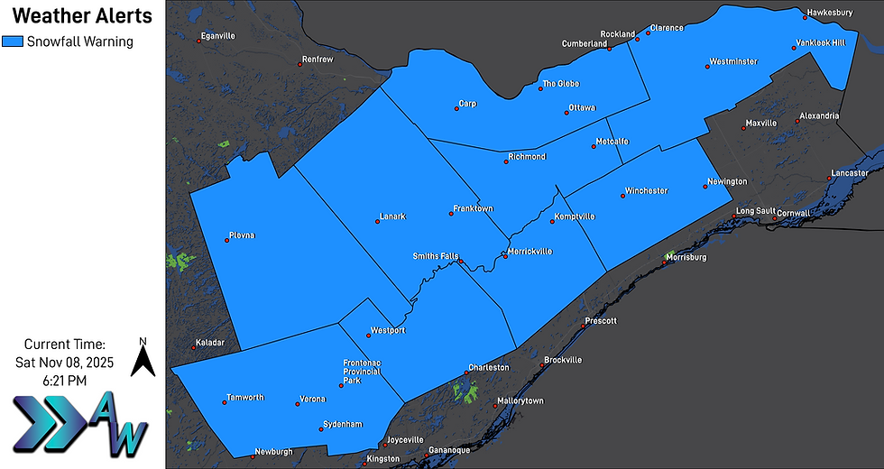
The heaviest snowfall is expected in Eastern Ontario, where 10 to 15 centimetres of snow appears possible. Environment Canada has issued a Snowfall Warning for portions of Eastern Ontario, including Ottawa, stating 10 to 20 centimetres of snow is possible.
As temperatures drop Sunday night into Monday morning, there is concern that wet and slushy roadways will quickly freeze over, leading to an icy morning commute on Monday. Remember - bridges ice first!
Additionally, lake effect snow will begin off Lake Huron and Georgian Bay during the early hours of Monday morning. Further forecast information will be posted tomorrow.


