
Snow Squalls Begin Sunday Night
- Austin Gagnier
- Nov 9, 2025
- 1 min read


After the first snow for many areas this winter, some snow squalls will begin developing this evening and will continue through Tuesday for some areas.
Due to a drop in temperature overnight into Monday morning, wet and slushy roads will turn icy quickly. In addition to this, snow squalls will create a layer of snow on top of the ice. Take caution and allow extra time for your morning commute.

A Snow Squall Watch has been issued as of Sunday evening for portions of Southwestern Ontario and Midwestern Ontario. Environment Canada states that snowfall amounts of 15 to 30 centimetres are possible overnight through Tuesday. Local blowing snow will also be possible, along with poor visibility.
Overnight into late Monday, snow squalls are expected to affect Southwestern Ontario, including Windsor-Essex, Chatham-Kent, Sarnia-Lambton and London-Middlesex. Ås winds shift late Monday into Tuesday, areas off Lake Huron such as London and Goderich will be affected. Areas off Georgian Bay such as Collingwood, Barrie, and possibly portions of the GTA will also likely see snow squalls.

In terms of snowfall amounts, the heaviest amounts are expected through portions of Chatham-Kent, Lambton County, and Middlesex County. Snow squalls can cause snowfall totals to largely vary due to localized conditions. Some areas may see higher snowfall amounts.
If planning to travel in affected areas overnight through Tuesday, ensure you drive to weather and road conditions. Snow squalls can cause conditions to vary from sunny skies to very poor visibility within only a few kilometres.


Forecasted radar for 7 AM Monday using HRRR model. Image via WeatherBELL.
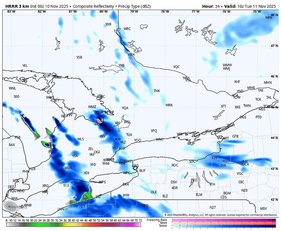
Forecasted radar for 5 AM Tuesday using HRRR model. Image via WeatherBELL.


