
STORM CENTRE: December 30, 2025 - January 4, 2026
- Advance Weather

- Jan 3
- 1 min read

LAST UPDATE: 12:45 AM, January 2 2026
NEXT UPDATE: 10:00 AM, January 2 2026
Discussion
Snow squalls will continue affecting the snow belt regions through Friday and Saturday. Although some of the snow squalls have weakened Thursday evening in Midwestern Ontario, they are expected to intensify again for Friday.
The main area of snowfall accumulation will likely be along Georgian Bay, where 15 to 25 centimetres of snow is likely through Saturday.
Road closures and poor travel conditions are expected, especially for areas that have already received significant snowfall.
Snow squall activity looks to wind down late Saturday, but more snow is likely both Sunday and Monday as systems move through the region. Both of these may fire up the lake effect snow machine once again.
Snow Squall Outlook - Friday and Saturday

Snow Squall Outlook - Wednesday and Thursday

NOTE: This Snow Squall Outlook includes system snow.
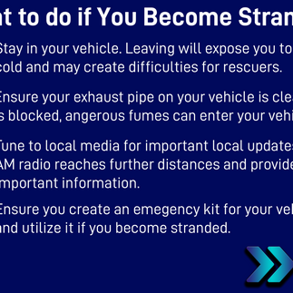
Safety Information


Closings and Cancellations
No data has been posted.
Road Closures
Transit Notices
No data has been posted.


